¶ Step 1: Go to the "Geofencings" tab
Geofencing consists of detecting devices within a radius/ring around an anchor/gateway and executing rules on these devices (changing position, field values, etc.)
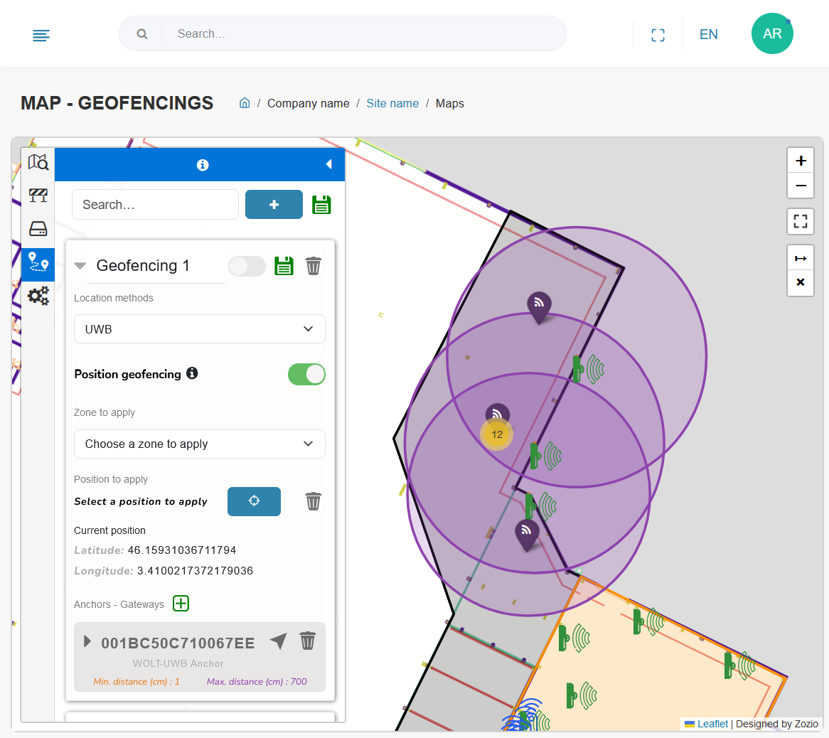
Once you've opened the "Maps" menu, you'll find the "Geofencing" tab in fourth position.
In this tab, you'll find all the geofencing that has already been created. You can rename them by typing the new name directly in place of the old one. The search bar lets you search for a geofencing name, or UIDs of a device added to the geofencing.

¶ Step 2: Adding and configuring a new geofencing
¶ Add geofencing :
To set up a new geofencing, first press the "+" icon.

Congratulations! Your new geofencing is ready to be configured.
¶ Geofencing configuration :
Don't forget to save your changes after editing by clicking on the green diskette!

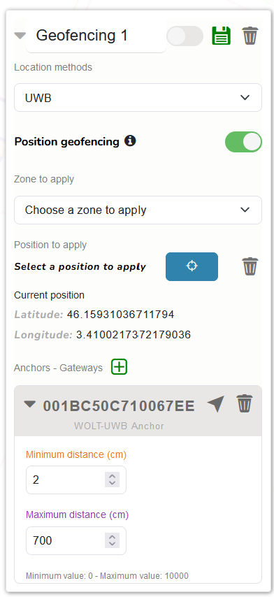
You must then enter the following information in the menu from top to bottom:
- Name you wish to give to this geofencing
- Location method. This must be supported by the anchor or gateway used as a reference for geofencing.
- Position geofencing
- if unchecked, geofencing will only be used to trigger automatic business rules on Robin
- if ticked, geofencing will also assign a position and zone to devices within the geofencing radius/ring
- Zone to be applied (recommended) zone to be assigned to all devices within the radius/ring around the anchor/gateway. This zone will be applied to assets paired to the device. The proposed zones correspond to the existing zones available in the "Zones" tab.
- Position to be applied (mandatory) position to be assigned to all devices within the radius/ring around the anchor/gateway. This position corresponds to the new latitude and longitude coordinates that the device will take into account when the georeferencing conditions are true. To define this position, first click on the target button, then click on the position to be applied to the map
- Anchors/gateways around which the geofencing rule will be applied. To do this, click on the green "+", enter the UID and press "OK".
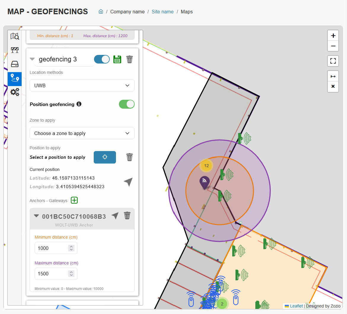
- Once the anchor(s)/gateway(s) have been added, a minimum and maximum distance must be entered, to create the device detection radius around the anchor/gateway. The detected device must be between these two distances for the geofencing rule to apply.
Tip: it is advisable to activate the "toggle" function beforehand, which gives an approximate representation on the map of the distances entered, as shown below. Note that distances in meters are exact distances, unlike those in RSSI, which are approximate.
